Thursday 27 June 2013

Climbing Scafell Pike - the roof of England!

I decided that I was ready for my next practise climb, and that the time to tackle Scafell Pike had arrived. At 978 metres, it is the highest mountain in England, but a little lower than Ben Nevis. Everyone I'd spoken to had told me Scafell Pike was "much harder" than Nevis, I wasn't sure what exactly they meant by this but it concerned me a little as climbing Ben Nevis had been physically exhausting. 

So at 6:30am I set off for the Lake District with my good friend Marta for company. I'd decided to take the Corridor route up Scafell Pike, which the Internet had described as a "long but gradual hike up the mountain." 

Our starting point at Seathwaite Farm

We started out from the farm at Seathwaite, and as promised the path was slow and gradual, with fantastic views of the surrounding mountains. A short while later we arrived at what the internet describes as a "spaghetti junction of footpaths" - a point where about a dozen paths all meet at a single location. After two wrong attempts and a short lunch break, we were finally on our way and making our ascent of the Corridor Path. 

The path started out slow and gradual
Marta on the path
'Styhead Tarn'


The e-guide had described the path as "well used and eroded in places" - what this actually meant in reality was "a rough and shabby path that they didn't bother to build in places." After making a steep scramble over a bank, the rocky path completely vanished, so we followed what we assumed to be the path - a path of slightly warn grass and fresh boot prints. 

View over the valley towards Wasdale Head

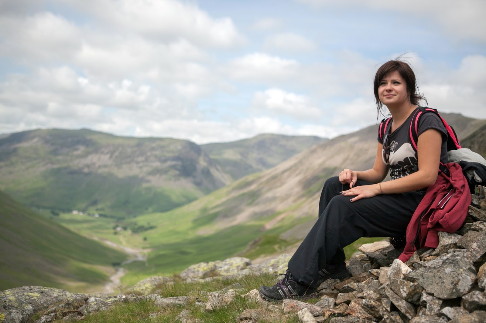
Marta in front of the valley
Panoramic view of the valley
Me in front of the valley

After a while of following the footprints and seeing no sign of human life, we did wonder whether this was the actual path or not. This footprint path finally lead us to a near vertical scramble up a very high bank, next to a waterfall. It was climbable, but very steep. This was definitely not the path we were supposed to be on! Once we'd finally reached the top, all signs of any sort of path had completely vanished. Going back down was impossible, we were well and truly lost in the peaks. 

I'd like to say that at this point I used my finely tuned orienteering skills to pinpoint our approximate location and navigate a route over the mountains. Except I don't have any orienteering skills - the extent of my orienteering knowledge is basically following Google Maps around town. There were no visible landmarks around, just peaks, peaks and more peaks in every direction - no telephone lines or fences etc. 

Taken from somewhere up in the peaks, well away from the path
Thankfully I did have a compass however, and I knew that almost our entire route consisted of heading due South. So using the compass we set of due South, not really sure of where we would end up, but enjoying the adventure of it all anyway. This was genuinely the first time in my life I have ever used a compass for anything other than curiosity, and I was very impressed with this age-old navigation tool! 


After about half an hour of scrambling over the hilltops, by complete chance we stumbled upon the path! The actual path that we had been aiming for all along!! We were delighted! 
There it is. The illusive path. Little bugger 

The path was fairly easy going all the way to the summit base, other than one point which involved climbing down a small cliff.

The summit itself was hard work, it's about 100metre high huge pile of rubble, which was hard work to ascend. I'd love to know where all this rubble comes from at the top of mountains, next time I meet a geologist I'll ask. To me it appeared as if they'd wanted to make the mountain a bit taller, and dumped a massive load of rubble on top to achieve this. I'm sure there's a much more sensible explanation. 

Finally we reached the top, it was a moment of rejoice! The views from the highest point in England were amazing, other than the mountain next to us which I swear looked taller. Perhaps it is taller, but they just tell you Scafell Pike is taller because it's easier to climb and less people would die in the challenge. 

Made it! Standing at the summit of Scafell Pike - highest point in England :-)
The summit of Scafell Pike is a giant mound of rubble

Panoramic summit view

Marta and I proudly at the top of Scafell Pike! 

We took a short break (I'd managed to save some food this time), then began our long, hard descent back down. Suddenly we were startled by a tremendous roar as an RAF Typhoon Fighter Jet rocketed through the valleys bellow us - amazing!! 

Overall, the climb wasn't nearly as physically demanding as Ben Nevis, but it was much harder to navigate and involved some challenging spots that required real climbing. 

All of this is in training for my big mountain climb next month of the Abeni Flue in Switzerland. I'm raising money for the fantastic charity Make A Wish, who grant children with life threatening conditions the chance to have their wish come true. Inspired? You can sponsor me at http://www.justgiving.com/joe-goes-up. Thank you so much to everyone who sponsored me already - I'm now at 25% of my target! 

Joe x

Friday 21 June 2013

Cycle to Fife

I woke up to a beautiful, warm sunny day yesterday in Edinburgh, and decided that instead of my usual climb, I was going to go for a nice bike-ride in training for my big climb next month. I'd spotted the Fourth Rail Bridge in the distance when I was out cycling recently, and thought it hadn't looked too far away, so I decided to head for that (it turned out to be 15 miles away... looks can be deceptive!)

I hadn't researched my route, as I'd wanted to explore more of Edinburgh and navigate by sense of direction. I knew that if I roughly followed the direction of the coast, I'd come to it sooner or later. 

After a while I found myself cycling along a beautiful footpath than ran alongside the River Almond. I genuinely had no idea this existed in Edinburgh, it was really tranquil. There was almost no one about, no tourists - the beauty of leaving the beaten track. 
The beautiful River Almond, Edinburgh


After a few hours I finally arrived at the base of the magnificent Fourth Rail Bridge. I was very tired at this point and wanted nothing more than to plonk myself down in one of the tempting pubs that sat at the foot of the bridges; however I knew I didn't have far to go and the end was in sight. 

First view of the Fourth Bridges, getting closer! 


The structure of the Fourth Rail Bridge is amazing

The Two Bridges

Me infront of the Fourth Road Bridge (left) and the Fourth Rail Bridge (right)
I continued on my path, crossing the 2-mile span over the amazing Fourth Road Bridge, until finally I arrived in the Kingdom of Fife; I had reached my destination!


From the base of the Fourth Road Bridge tower


Panorama of the Fourth Road Bridge

Made it! The end of the Bridge, taken from the Kingdom of Fife! 

I decided to take a different route home, and followed a blue-signposted cycle path which promised to get me back to the city centre in 10 miles. It soon became clear that something wasn't quite right with these signs. About half an hour after passing a sign which said "city centre 6 miles" I arrived at another sign which said "city centre 7 miles." 

After over an hour of following these confusing, mind boggling labyrinth of silly blue signs, the path finally lead me right to a KFC, where the blue signs promptly vanished. The path came out right at the back, where they pump out the finger-lickin' good smells. I was physically and mentally exhausted; it was then that I realised I'd been well and truly stitched up. I'd fallen victim to one of the greatest marketing cons I'd ever witnessed; a series of signs which suggest a cycle route that plays with your mind, tires your body, then dumps you out at a fast food joint. Perfect. I frustratedly ignored the overwhelming desire to munch on some Kentucky Fried chicken and chips, and turned around to continue my journey. I saw a blue sign pointing back in the direction I'd just come from, which read "Edinburgh, 10 miles." 

I'd had enough of this game, and by cycling to the top of the hill was able to spot Arthers Seat in the distance. Using this as a navigation point, I made my own way home and arrived back about 45 minutes later. 

All of this is in preparation for my big climb next month, less than four weeks away. I'm raising money for Make-A-Wish UK, an amazing charity that makes the wishes of sick and dying children come true. Inspired? Please help me achieve this goal, and head over to http://www.justgiving.com/joe-goes-up. Every penny helps. Thank you, Joe x

Sunday 16 June 2013

Climbing Ben Nevis

Having purchased my awesome new North Face Verto S4K GTX grade II mountaineering boots yesterday evening, I was DYING to test these bad boys out, and within about 10 minutes had decided I was off to climb Ben Nevis the next day - the highest mountain in Britain. Towering above the West of Scotland at an impressive 1,344 metres, Ben Nevis is a little over a third of the height of the Abeni Flue that I will be tackling next month, so I figured it would make for a good warm up climb. 

So at 6am this morning, I set off from Edinburgh, arriving at the foot of the Glen Nevis range three hours later. 

The climb started off well, and I was pleased to see that my casual walking pace was faster than the majority of people setting off at the same time as me; it seemed my training had done some good. 

Beginning of the walk up Ben Nevis, running paralel to Glen Nevis Valley

I noticed a macho looking group of lads not far ahead, and decided beating them would be my target for the day. As I passed the lad group a few minutes later, I heard they were all talking with Glaswegian accents; suddenly this was no longer simply a challenge, this was a matter of national pride! 

The lad group struggling to keep up 

Views over the valley 

The path snaking its way up the mountain

About halfway up the mountain, the temperature dropped significantly and the air became much lighter, making climbing a lot easier. I was surprised at how tough the walk was, I had expected the path to be much less challenging. It involves quite a bit of scrambling over rocks in places. I was really amazed at my new boots - the grip was unbelievable! Whatever I threw at these boots they 'took in their stride' (no pun intended :P) - rocks, mud, streams, no problem. They were very comfortable and felt great instantly - no wearing-in needed. The support on my ankle was phenomenal; I've no doubt I would have had a badly twisted ankle were it not for this. Their grip held strong where I noticed a lot of others on the path slipping. I chatted to a few people on the climb up, and exchanged stories with fellow climbers and travellers, it was nice. A lot of people were climbing Ben Nevis for charity, and were surprised to hear that this was just my pre-charity climb :)

Time for a quick photo stop. 


Pausing to reflect on life and watch the world go by

Admiring my progress


Once I reached cloud level, the walk became very peaceful, if not a little eerie. Everyone else had disappeared, and all I could see in all directions was white. There were no birds this high, infact I have never experienced such intense silence. No animals, no traffic, no wind, just complete silence. 

The path become very rocky


Climbing into the cloud


The approach to Mordor was a little glum

A hole in the cloud appeared for a couple of minutes to give me this staggering view


A loan hiker does her best to escape the Dementors 

I was disappointed to discover that I had eaten both my food supply for the day and my emergency rations (incase I got stranded on the mountain) by lunchtime, and hadn't left any for the return journey. I really must get better at rationing. 

The approach to the summit involved crossing a large snow patch. I was very excited by this as I have never seen snow in the UK in summer before, I wasn't expecting to see any! 

Standing on the edge of the snow patch. 

EXCITED by seeing snow in Summer!! 


A final short trek that ran a few metres parallel to the the magnificent and perilous North Face was all that was between the summit and I, and I could see the entire summit was covered in snow. 

The final stretch! 


Cloud parts to give me this amazing view! 

Watching the clouds roll around 


The infamous and deadly North Face - the highest cliffs in the UK

Standing infront of the North Face 


I had expected reaching the summit to be a euphoric moment; an overwhelming sense of achievement . I envisioned a handful of proud blokes shaking each others' hands and high-fiving each other. The reality when I got there was around 100 people hanging around the summit, including a tour group of about 50 teenagers, loitering around shouting in a foreign language and smoking. This was NOT what I had expected! Hopefully the Abeni Flue summit will be a little less popular. 

I gave my Dad a quick call from the top to wish him a happy fathers day. He sounded surprised when he asked what I was up to, and I casually replied with "oh I'm just at the top of Ben Nevis."

As I was leaving the summit I passed the lad group arriving, looking red-faced and out of breath. Victory! 

The summit of Ben Nevis - crowded with people


The brave little dog make it to the top! 

Made it! Ben Nevis - conquered! Next: Abeni Flue :P 

The climb down was torture, much much harder than the climb up! Most of the top half of the path is covered in loose shingle and rocks - these were easy to navigate on the way up, but coming down meant my foot would land in one place and end up in another, putting a lot of strain on my ankles and knees - particularly the knee with no ligament which gives me stability issues! 

The lower part of the climb is big solid rocks. However it had started raining, which had caused these to become extremely slippery. 

Three hours later I arrived happily back at my car and sank into the drivers seat. The drive home was possibly the hardest part of the day - I was exhausted, and could barely work the pedals. 

I'm doing all of this to raise money for Make A Wish charity - a truly wonderful cause. Throughout the climb I kept reminding myself that no matter how hard or exhausting it was, it's not nearly as bad as what a child undergoing chemotherapy has to go through. If you'd like to sponsor me, just go to www.justgiving.com/joe-goes-up  - every penny you give goes directly to the charity. 

Joe x